
Walk a Rogers Street by Address
A street directory search should move from the present parcel to increasingly specific documentary evidence. The address finds the county tract. The parcel card supplies an owner, deed reference, and legal description. The deed index can then identify earlier parties to the same land. Voter data and reverse directories may add residence clues, but each has access limits and incomplete coverage.
- Enter the exact house number and street in the Benton County property search. Copy the situs address, parcel number, current owner, separate mailing address, current deed reference, and legal description.
- Open the Benton County Basemap or focused Parcels viewer. Identify the same polygon and inspect neighboring lots one at a time.
- Use the current deed reference in the Circuit Clerk's land service. Confirm the grantor, grantee, record date, instrument or book and page, and matching legal description.
- Treat VoterView as a self-verification tool. For lawfully released voter data, preserve its restrictions and never infer ballot choices.
- For older names, consult the verified 1996 cross-reference directory and other known local volumes, then check census, obituary, or probate sources.
This sequence prevents a common error: treating a tax-mail destination as proof of who occupies the Rogers address. It also keeps the parcel's durable identity intact when a street label, postal city, or municipal boundary is unclear.
Search Rogers Parcel Roll Fields
The Benton County Assessor's Real Estate Records page links to the public ARCountyData search. Its three main modes let a street directory user begin with a person, a place, or a known county key. Results may show ownership, situs and mailing addresses, parcel number, legal description, acreage, current deed and transfer history, land and building details, assessed value, homestead status, plats, and district assignments.
| Portal field | Entry type | Required | How it helps by street |
|---|---|---|---|
| County | Selector | At gateway | Choose Benton County for Rogers parcels |
| Owner name | Text search | One criterion | Find street property held by a known person or entity |
| Property address | Number and street | One criterion | Open the parcel at an exact situs |
| Parcel number | Exact identifier | One criterion | Return to the same tract without name ambiguity |
| Reset or New Search | Control | No | Clear criteria before moving to the next lot |
The successful capture below comes from the Benton County property-search interface.
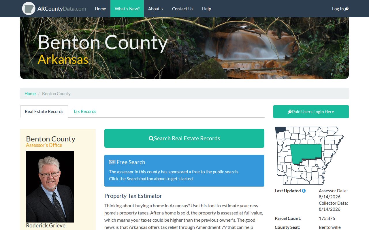
The portal turns an address into a parcel card, which supplies the fixed reference needed for deed, plat, permit, and map research.
Note: The assessor describes its parcel roll as working information without warranty, so use the recorded deed for title facts.
Rogers Street Directory Sources
Every address-keyed source sees a different layer of a Rogers street. Chaining them works only when the parcel number and legal description remain attached to the search notes. A name alone can point to a namesake, while a street spelling can change or be entered in more than one form.
| Address source | Street evidence | Access route | What remains unknown |
|---|---|---|---|
| Parcel GIS | Lot outline, owner, situs, mailing, legal facts | Free viewer after disclaimer | Occupants and survey-grade boundary |
| Assessor card | Owner, transfer, homestead, building, valuation | Web portal or Rogers office | Every household member |
| Recorded deed | Parties, date, legal description, document reference | Paid web images or Bentonville counter | Whether a party lived there |
| Permit record | Applicant, contractor, work, date, value, parcel PIN | Guest portal, archive, or request | Residency of named parties |
| Voter product | Released registration address and districts | Formal state request, not street browse | Protected people and ballot choices |
| Reverse directory | Listed householder or business by address | Museum or cataloged volume | Unlisted people and missing years |
When the source roles conflict, the conflict may be real. A trust can hold title, a post office box can receive tax mail, and an applicant can obtain a permit without living at the site. The address record chain must preserve those distinctions.
Map Rogers Street Parcels One by One
The Benton County Basemap includes Basic, Parcel, Plat, Advanced, and Spatial Search modes plus Layers, Identify, Measure, Draw, Query, and Print controls. After finding an address, open Spatial, select Parcels as the target layer, and use Intersect By on the address result. The focused Parcels application is useful for clicking adjacent polygons, while the county GIS department provides map and address-verification help when the viewer fails.
No one-click radius or buffer tool was verified. Browse a street segment by clicking each parcel in order. Record the parcel ID, situs, owner, separate mailing city, and legal description before moving to the next lot. Measure can define a street segment, while Draw and Print can preserve the working map. The result is informational and is not a legal survey.
- Parcel
- A mapped tract identified in the county property system.
- Situs address
- The physical location assigned to the parcel, distinct from the owner's mail destination.
- Plat
- A recorded map showing lots, blocks, subdivisions, and related boundaries.
- Criss-cross directory
- A directory ordered by street and house number rather than only by surname.
Note: Across an alley or common area, the subdivision plat helps decide whether a lot belongs to the same block.
Rogers Mailing and Situs Street Clues
Owner mailing and situs addresses should always be read side by side. Situs is the mapped location. Mailing is where the owner chose to receive tax correspondence, which may be another city, an office, or a post office box. A matching pair plus a homestead indicator supports owner occupancy, but still does not name other people at the address.
A different mailing address is only a lead. It can reflect nonoccupancy, entity ownership, a recent move, or a preferred mail destination. Property ownership also does not establish voter residence. Those distinctions are central to a responsible Rogers address search because a parcel roll names ownership, not a complete household.
Address flow. Street address → parcel number → owner and mailing address → deed reference → legal description → grantor and grantee trail.
Trace Rogers Street Owners Through Deeds
The Benton County Circuit Clerk public-records page explains the recorder channels. Begin with the current deed reference from the assessor. In that recorded instrument, the grantor is the seller and the grantee is the buyer. To step back, search the current buyer as an earlier grantee, open the acquisition deed, and repeat. Confirm the same lot, block, subdivision, or metes-and-bounds description at every turn.
The current vendor FAQ gives index coverage from May 3, 1945 and images from January 31, 1933, with series-specific dates. Its deed images reach 1933, mortgage records reach 1970, and other categories begin later. Before October 30, 2017, documents are retrieved by book and page; later land instruments use a number starting with “L.” The county's older summaries give different date cutoffs, so a missing online item calls for a counter check.
The land-record service separates public index search from paid image access. Published vendor plans include subscription levels and pay-as-you-go viewing. The Recorder counter at 215 E. Central, Room 202, Bentonville, is open weekdays from 8:00 a.m. to 4:30 p.m. It is the fallback for early books, marginal notes, incomplete online coverage, and copy questions. Benton County Historical Society deed microfilm reaches 1837.
Rogers Street Permit Records
The Rogers Public Permits Portal presents account sign-in, account creation, and Guest Access. Archived city reports show address, applicant or contractor, work description, status, valuation, fees, and parcel PIN as useful concepts. Exact live guest filters were not verified, so search only through fields actually shown by the portal.
The successful screenshot below shows the Rogers public permits entry page.
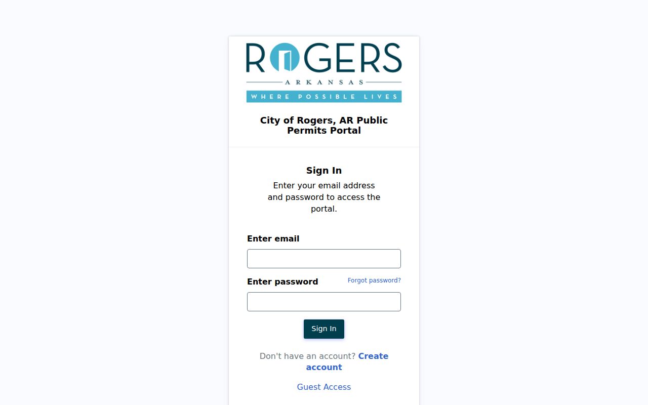
Guest Access adds a city record layer to the address trail when a project, applicant, or permit date is relevant.
For older or hard-to-find files, search the Rogers Archive Center by address number and street, then by surname. A narrow Arkansas Freedom of Information Act request can ask for an existing, nonexempt permit log or application by address and date range. A permit proves work or a named role, not household occupancy.
Rogers Streets Cross Boundaries
A Rogers postal city or ZIP label can extend outside the municipal boundary. ZIP 72756 generally covers downtown, north, and east Rogers plus routes toward Beaver Lake and unincorporated county. ZIP 72758 generally covers south and west Rogers and Pinnacle-area routes. The box-only 72757 is not a neighborhood polygon. None of these labels decides city jurisdiction.
Annexation follows contiguous parcels and legal descriptions. City GIS layers include addresses, parcels, subdivisions, roads, city and nearby-city boundaries, flood areas, and historic districts. County GIS adds ZIP-area and political-boundary maps. When jurisdiction matters, compare the parcel against the city boundary and annexation record instead of relying on the mailing label.
The Highway 112 and Cave Springs issue illustrates the risk. Three parcels involved in Rogers election timing had petitioned into Cave Springs, and a city resolution sought to clarify residency. Parcel law and city-boundary records resolved the question, not the Rogers postal name.
Older Rogers Streets Need Legal Keys
No official Rogers street-renumbering year was verified. When an old directory address fails in the current parcel search, do not assume the house vanished. Compare lot, block, subdivision, deed descriptions, plat sheets, and sequential Sanborn maps. The Library of Congress has Rogers Sanborn editions from 1896, 1901, 1908, 1914, 1923, and 1948. Those maps date building form and use, not occupants.
The verified 1996 R.L. Polk Northwest Arkansas Cross-Reference Directory can run from street and house number to a listed householder or business. Other known regional books exist for selected later years. The Rogers Directory Book page covers the shelf and catalog evidence. A reverse entry should be paired with deeds, census, obituary, or probate records because publication and listing gaps remain.
The legal description is the bridge. It can survive a street spelling change, municipal growth, or new postal label when the same physical tract remains.
Rogers Voter Street Data
VoterView lets a voter check registration and polling details. It cannot browse everyone on a street. The Arkansas Secretary of State provides a formal data request for registration, vote history, or a combined product. A released registration file can include a residential or mailing address, precinct, districts, and other fields subject to law and the fulfilled data dictionary.
Vote history indicates participation only. It never reveals a ballot choice. Protected addresses, signatures, full Social Security numbers, and full license details do not become public simply because a data product exists. The Benton County Clerk is the voter registrar, with a Rogers branch at 2111 W. Walnut Street. County Archives may hold historical voter material, though no year run is published.
Property ownership is not voter residence. An inactive record or failed self-lookup also cannot prove that someone left the street. A by-address search must avoid filling those gaps with guesses.
Rogers Street Search Fallbacks
When a portal fails, move to the office that keeps the record. Assessor and County Clerk satellite functions are available in Rogers. Recorder deed-book work remains at the Bentonville courthouse or through the land web service. County Archives accepts a focused research request with name variants, dates, place or address, and record type. Its film and optical holdings include taxes, probate, voter records, roads, schools, cemetery books, and niche registers.
The Arkansas Attorney General's FOIA overview explains how the Freedom of Information Act applies to identifiable, existing, nonexempt city and county files. Ask for electronic copies when they already exist. Agencies may charge actual reproduction cost and mailing, and records in active use or storage can take up to three working days. The current Arkansas FOIA Handbook supplies the statute and exemptions. FOIA cannot open protected voter addresses, restricted vital records, sealed court files, or other material closed by law.
Rogers Street Directory Privacy
An address lookup cannot reveal a complete household. Parcel systems omit renters and other residents. Utility customer and delivery data are not public resident lists. Motor-vehicle personal information is restricted by the federal Driver's Privacy Protection Act. Arkansas's Address Confidentiality Program gives eligible survivors a substitute address in participating public systems.
Do not try to infer an actual protected address from a blank, substitute, or inconsistent field. Public availability also does not permit unwanted surveillance, impersonation, threats, or repeated contact. Arkansas stalking and harassment laws apply to harmful conduct regardless of where a name or address was found.
Lawful use. Rogers street records may support family history, property research, civic review, and scam prevention. Never use them to stalk, harass, intimidate, or harm a person.
Commercial neighbor tools mix official and commercial data, can merge names, and may hide source dates. The official parcel, deed, permit, and clerk records are narrower but easier to verify. Record the access date and confirm any important conclusion with the custodian.